![](/images/other/stat-length.png)
![Excursión Bici de montaña La Flèche - La Flèche Nord - Photo](https://media.geolcdn.com/t/1900/400/ext.pjpeg?maxdim=2&url=https%3A%2F%2Fservices.sitytrail.com%2FGeolivesWS%2FDownloadMedia.ashx%3FTrailID%3D118815%26Media%3D13023_1.jpg)
La Flèche Nord
tracegps
Usuario
![Longitud](/images/other/stat-length.png)
Longitud
31 km
![Altitud máxima](https://static1.geolcdn.com/siteimages/upload/files/1508320355ic_sort_altitude_max_24dp.png)
Altitud máxima
110 m
![Desnivel positivo](https://static1.geolcdn.com/siteimages/upload/files/1508320355ic_sort_den_pos_24dp.png)
Desnivel positivo
313 m
![Km-Effort](/images/other/stat-length.png)
Km-Effort
35 km
![Altitud mínima](https://static1.geolcdn.com/siteimages/upload/files/1508320355ic_sort_altitude_min_24dp.png)
Altitud mínima
26 m
![Desnivel negativo](https://static1.geolcdn.com/siteimages/upload/files/1508320355ic_sort_den_neg_24dp.png)
Desnivel negativo
315 m
![Boucle](https://static1.geolcdn.com/siteimages/upload/files/16400158638029165_repeat_loop_refresh_sync_direction_icon.png)
Boucle
Sí
Fecha de creación :
2014-12-10 00:00:00.0
Última modificación :
2014-12-10 00:00:00.0
![Bici de montaña](https://static1.geolcdn.com/sitytour/trail-icons/202.png)
2h15
Dificultad : Medio
![Escanee este código QR para abrir la excursión en la aplicación SityTrail](https://capi.geolives.com/qq0zvz2zws4bq2lad0pu/sitytour/trails/118815/qr.png?size=200)
Aplicación GPS de excursión GRATIS
A propósito
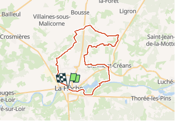
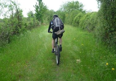
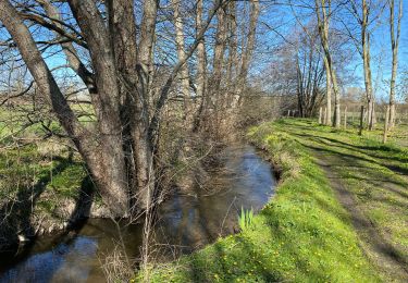
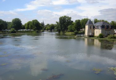
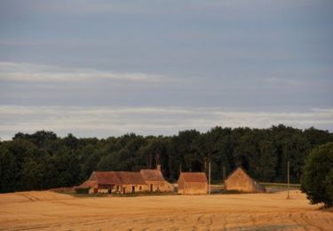
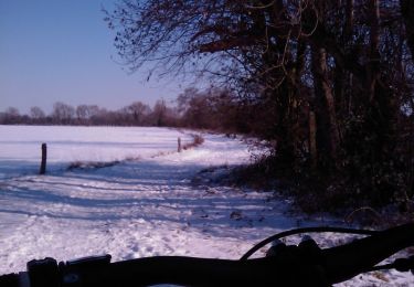
Ruta Bici de montaña de 31 km a descubrir en Países del Loira, Sarthe, La Flèche. Esta ruta ha sido propuesta por tracegps.
Descripción
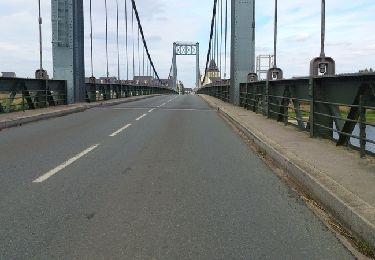
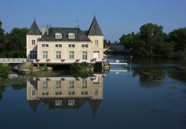
Petite boucle agréable au départ de la Flèche. Quelques beaux chemins creux. Retour par les bords de loir jusqu'au centre ville. Difficulté moyenne.
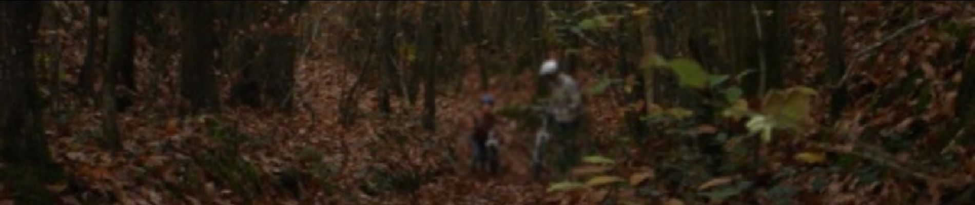
Localización
País:
France
Región :
Países del Loira
Departamento/provincia :
Sarthe
Municipio :
La Flèche
Localidad:
Unknown
Salida:(Dec)
Salida:(UTM)
719472 ; 5286724 (30T) N.
Comentarios
Excursiones cerca
![Excursión Bici de montaña La Flèche - La Flèche Sud - Photo](https://media.geolcdn.com/t/375/260/ext.jpg?maxdim=2&url=https%3A%2F%2Fstatic1.geolcdn.com%2Fsiteimages%2Fupload%2Ffiles%2F1524743154velo.jpg)
![Bici de montaña Bici de montaña](https://static1.geolcdn.com/sitytour/trail-icons/202.png)
La Flèche Sud
Bici de montaña
Medio
(2)
La Flèche,
Países del Loira,
Sarthe,
France
![](/images/other/stat-length.png)
46 km | 51 km-effort
3h 15min
![](https://static1.geolcdn.com/siteimages/upload/files/16400158638029165_repeat_loop_refresh_sync_direction_icon.png)
Sí
![Excursión Bici de montaña La Flèche - La Flèche - Saumur par les chemins - Photo](https://media.geolcdn.com/t/375/260/ext.jpg?maxdim=2&url=https%3A%2F%2Fservices.sitytrail.com%2FGeolivesWS%2FDownloadMedia.ashx%3FTrailID%3D316964%26Media%3D16084_6.jpg)
![Bici de montaña Bici de montaña](https://static1.geolcdn.com/sitytour/trail-icons/202.png)
La Flèche - Saumur par les chemins
Bici de montaña
Medio
La Flèche,
Países del Loira,
Sarthe,
France
![](/images/other/stat-length.png)
88 km | 99 km-effort
5h 0min
![](https://static1.geolcdn.com/siteimages/upload/files/16400158638029165_repeat_loop_refresh_sync_direction_icon.png)
No
![Excursión Bici de montaña La Flèche - La Flèche - Grande Boucle Sud Ouest - Photo](https://media.geolcdn.com/t/375/260/ext.jpg?maxdim=2&url=https%3A%2F%2Fservices.sitytrail.com%2FGeolivesWS%2FDownloadMedia.ashx%3FTrailID%3D215065%26Media%3D15639_6.jpg)
![Bici de montaña Bici de montaña](https://static1.geolcdn.com/sitytour/trail-icons/202.png)
La Flèche - Grande Boucle Sud Ouest
Bici de montaña
Difícil
La Flèche,
Países del Loira,
Sarthe,
France
![](/images/other/stat-length.png)
84 km | 96 km-effort
6h 0min
![](https://static1.geolcdn.com/siteimages/upload/files/16400158638029165_repeat_loop_refresh_sync_direction_icon.png)
Sí
![Excursión Bici de montaña La Flèche - Tour de la Flèche en 4 Jours - Photo](https://media.geolcdn.com/t/375/260/ext.jpg?maxdim=2&url=https%3A%2F%2Fservices.sitytrail.com%2FGeolivesWS%2FDownloadMedia.ashx%3FTrailID%3D172268%26Media%3D13580_3.jpg)
![Bici de montaña Bici de montaña](https://static1.geolcdn.com/sitytour/trail-icons/202.png)
Tour de la Flèche en 4 Jours
Bici de montaña
Fácil
La Flèche,
Países del Loira,
Sarthe,
France
![](/images/other/stat-length.png)
163 km | 181 km-effort
16h 0min
![](https://static1.geolcdn.com/siteimages/upload/files/16400158638029165_repeat_loop_refresh_sync_direction_icon.png)
Sí
![Excursión Cicloturismo La Flèche - La Flèche, Luché pringé - Photo](https://media.geolcdn.com/t/375/260/ext.jpg?maxdim=2&url=https%3A%2F%2Fstatic1.geolcdn.com%2Fsiteimages%2Fupload%2Ffiles%2F1524743154velo.jpg)
![Cicloturismo Cicloturismo](https://static1.geolcdn.com/sitytour/trail-icons/204.png)
La Flèche, Luché pringé
Cicloturismo
Fácil
La Flèche,
Países del Loira,
Sarthe,
France
![](/images/other/stat-length.png)
33 km | 35 km-effort
2h 15min
![](https://static1.geolcdn.com/siteimages/upload/files/16400158638029165_repeat_loop_refresh_sync_direction_icon.png)
No
![Excursión Bici de montaña La Flèche - Nico tout seul très beau temps - Photo](https://media.geolcdn.com/t/375/260/195ac492-309c-4a9f-bfb4-f1b1c36a915d.jpg&format=jpg&maxdim=2)
![Bici de montaña Bici de montaña](https://static1.geolcdn.com/sitytour/trail-icons/202.png)
Nico tout seul très beau temps
Bici de montaña
La Flèche,
Países del Loira,
Sarthe,
France
![](/images/other/stat-length.png)
29 km | 32 km-effort
1h 35min
![](https://static1.geolcdn.com/siteimages/upload/files/16400158638029165_repeat_loop_refresh_sync_direction_icon.png)
Sí
![Excursión Bici de montaña La Flèche - La Flèche - Grande Boucle Nord Est - Photo](https://media.geolcdn.com/t/375/260/ext.jpg?maxdim=2&url=https%3A%2F%2Fservices.sitytrail.com%2FGeolivesWS%2FDownloadMedia.ashx%3FTrailID%3D215075%26Media%3D15651_2.jpg)
![Bici de montaña Bici de montaña](https://static1.geolcdn.com/sitytour/trail-icons/202.png)
La Flèche - Grande Boucle Nord Est
Bici de montaña
Difícil
La Flèche,
Países del Loira,
Sarthe,
France
![](/images/other/stat-length.png)
88 km | 101 km-effort
6h 0min
![](https://static1.geolcdn.com/siteimages/upload/files/16400158638029165_repeat_loop_refresh_sync_direction_icon.png)
Sí
![Excursión Bici de montaña La Flèche - La Flèche Nord Ouest - Photo](https://media.geolcdn.com/t/375/260/ext.jpg?maxdim=2&url=https%3A%2F%2Fservices.sitytrail.com%2FGeolivesWS%2FDownloadMedia.ashx%3FTrailID%3D118816%26Media%3D13025_1.jpg)
![Bici de montaña Bici de montaña](https://static1.geolcdn.com/sitytour/trail-icons/202.png)
La Flèche Nord Ouest
Bici de montaña
Fácil
La Flèche,
Países del Loira,
Sarthe,
France
![](/images/other/stat-length.png)
35 km | 39 km-effort
2h 30min
![](https://static1.geolcdn.com/siteimages/upload/files/16400158638029165_repeat_loop_refresh_sync_direction_icon.png)
Sí
![Excursión Bici de montaña La Flèche - La Fleche - Nord Est - Photo](https://media.geolcdn.com/t/375/260/ext.jpg?maxdim=2&url=https%3A%2F%2Fservices.sitytrail.com%2FGeolivesWS%2FDownloadMedia.ashx%3FTrailID%3D118814%26Media%3D13022_1.jpg)
![Bici de montaña Bici de montaña](https://static1.geolcdn.com/sitytour/trail-icons/202.png)
La Fleche - Nord Est
Bici de montaña
Medio
La Flèche,
Países del Loira,
Sarthe,
France
![](/images/other/stat-length.png)
42 km | 48 km-effort
3h 0min
![](https://static1.geolcdn.com/siteimages/upload/files/16400158638029165_repeat_loop_refresh_sync_direction_icon.png)
Sí